Exposing the invisible with satellite imagery
For journalists and others, satellite images offer a new world of possibilities
Until 2005, to observe the Earth from space, you had to be an astronaut.
Today, with a simple Internet connection, some free tools and millions of freely available satellite images, the entire planet is at your fingertips.
In journalism, as in many professional activities, these images open up unprecedented possibilities.
First, to illustrate the climate emergency and the impact of human activity on the environment.
The transformations of the planet, even in the most remote places of the Amazon, Central Africa or Siberia, can now be visualized, analyzed and compared over time from any PC.

Human activities that degrade the environment and destroy biodiversity, such as accelerated deforestation in the Amazon (below) and elsewhere, overfishing and illegal fishing, oil spills and pollution of all kinds… almost nothing is out of reach for the image sensors of the satellites that orbit the Earth.

These sensors, like those of the European Sentinel constellation, make it possible to visualize the surface of the Earth in natural colors (those of the rainbow), as well as what is invisible to the naked eye in the light spectrum, such as infrared (to view burned areas, soil moisture and aridity, etc.).
Some generate very high resolution images (0.5m). Others allow to see things at night or through clouds, thanks to radar imagery, like this animation in cloudy weather of floods caused by cyclone Eloise (Beira, Mozambique, January 2021).

Mapping and satellite imagery tools herald a new era in the coverage of armed conflicts and areas inaccessible to the media (Ukraine, Syria, North Korea, etc.).
They are used to document terrorist activities (Boko Haram in Nigeria, etc.) and abuses committed by the military (Cameroon, Myanmar, etc.). They are used to illustrate areas of geostrategic tension (Chinese territorial ambitions in the Himalayas and in the South China Sea, construction of the Renaissance Dam on the Blue Nile in Ethiopia, etc.), and refugee movements caused by wars and climate change.

Coupled with artificial intelligence, they allow civil society organizations to fight against human rights violations, such as modern slavery in the brick kilns of northern India, Pakistan, Bangladesh, and Nepal, the internment camps of Uyghurs in Xinjiang, or the actions of those pirates who exploit slave fishermen in the middle of the Pacific.

Learn more about my training program : Investigative journalism with satellite imagery.
 https://bourgoing.com/wp-content/uploads/2024/11/0_2.jpg
816
1456
Robert Bourgoing
http://bourgoing.com/wp-content/uploads/2021/11/Robert-Bourgoing-couleur.svg
Robert Bourgoing2024-11-20 14:00:222024-12-12 12:00:34Learn to Master the Art of Digital Fact-Checking
https://bourgoing.com/wp-content/uploads/2024/11/0_2.jpg
816
1456
Robert Bourgoing
http://bourgoing.com/wp-content/uploads/2021/11/Robert-Bourgoing-couleur.svg
Robert Bourgoing2024-11-20 14:00:222024-12-12 12:00:34Learn to Master the Art of Digital Fact-Checking https://bourgoing.com/wp-content/uploads/2024/11/Tuto01.png
816
1456
Robert Bourgoing
http://bourgoing.com/wp-content/uploads/2021/11/Robert-Bourgoing-couleur.svg
Robert Bourgoing2024-11-20 13:45:532024-12-12 11:58:101. The Fact-Checkers Browser
https://bourgoing.com/wp-content/uploads/2024/11/Tuto01.png
816
1456
Robert Bourgoing
http://bourgoing.com/wp-content/uploads/2021/11/Robert-Bourgoing-couleur.svg
Robert Bourgoing2024-11-20 13:45:532024-12-12 11:58:101. The Fact-Checkers Browser https://bourgoing.com/wp-content/uploads/2024/11/Tuto02.png
816
1456
Robert Bourgoing
http://bourgoing.com/wp-content/uploads/2021/11/Robert-Bourgoing-couleur.svg
Robert Bourgoing2024-11-20 13:40:302024-12-12 11:57:582. The Browser Extensions
https://bourgoing.com/wp-content/uploads/2024/11/Tuto02.png
816
1456
Robert Bourgoing
http://bourgoing.com/wp-content/uploads/2021/11/Robert-Bourgoing-couleur.svg
Robert Bourgoing2024-11-20 13:40:302024-12-12 11:57:582. The Browser Extensions https://bourgoing.com/wp-content/uploads/2024/11/Tuto03-2.png
816
1456
Robert Bourgoing
http://bourgoing.com/wp-content/uploads/2021/11/Robert-Bourgoing-couleur.svg
Robert Bourgoing2024-11-20 13:35:222024-12-12 11:57:383. Managing Bookmarks
https://bourgoing.com/wp-content/uploads/2024/11/Tuto03-2.png
816
1456
Robert Bourgoing
http://bourgoing.com/wp-content/uploads/2021/11/Robert-Bourgoing-couleur.svg
Robert Bourgoing2024-11-20 13:35:222024-12-12 11:57:383. Managing Bookmarks https://bourgoing.com/wp-content/uploads/2024/11/Tuto04.png
816
1456
Robert Bourgoing
http://bourgoing.com/wp-content/uploads/2021/11/Robert-Bourgoing-couleur.svg
Robert Bourgoing2024-11-20 13:30:392024-12-12 11:59:134. Fact-Checking Photos – part 1
https://bourgoing.com/wp-content/uploads/2024/11/Tuto04.png
816
1456
Robert Bourgoing
http://bourgoing.com/wp-content/uploads/2021/11/Robert-Bourgoing-couleur.svg
Robert Bourgoing2024-11-20 13:30:392024-12-12 11:59:134. Fact-Checking Photos – part 1 https://bourgoing.com/wp-content/uploads/2024/11/Tuto05.png
816
1456
Robert Bourgoing
http://bourgoing.com/wp-content/uploads/2021/11/Robert-Bourgoing-couleur.svg
Robert Bourgoing2024-11-20 13:25:122024-12-12 11:57:045. Fact-Checking Photos – part 2
https://bourgoing.com/wp-content/uploads/2024/11/Tuto05.png
816
1456
Robert Bourgoing
http://bourgoing.com/wp-content/uploads/2021/11/Robert-Bourgoing-couleur.svg
Robert Bourgoing2024-11-20 13:25:122024-12-12 11:57:045. Fact-Checking Photos – part 2 https://bourgoing.com/wp-content/uploads/2024/11/Tuto06.png
816
1456
Robert Bourgoing
http://bourgoing.com/wp-content/uploads/2021/11/Robert-Bourgoing-couleur.svg
Robert Bourgoing2024-11-20 13:20:202024-12-12 11:56:556. Verifying Videos – part 1
https://bourgoing.com/wp-content/uploads/2024/11/Tuto06.png
816
1456
Robert Bourgoing
http://bourgoing.com/wp-content/uploads/2021/11/Robert-Bourgoing-couleur.svg
Robert Bourgoing2024-11-20 13:20:202024-12-12 11:56:556. Verifying Videos – part 1 https://bourgoing.com/wp-content/uploads/2024/11/Tuto07-1.png
816
1456
Robert Bourgoing
http://bourgoing.com/wp-content/uploads/2021/11/Robert-Bourgoing-couleur.svg
Robert Bourgoing2024-11-20 13:15:492024-12-12 11:56:467. Verifying Videos – part 2
https://bourgoing.com/wp-content/uploads/2024/11/Tuto07-1.png
816
1456
Robert Bourgoing
http://bourgoing.com/wp-content/uploads/2021/11/Robert-Bourgoing-couleur.svg
Robert Bourgoing2024-11-20 13:15:492024-12-12 11:56:467. Verifying Videos – part 2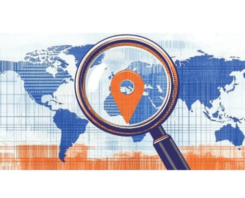 https://bourgoing.com/wp-content/uploads/2024/11/Tuto08.png
816
1456
Robert Bourgoing
http://bourgoing.com/wp-content/uploads/2021/11/Robert-Bourgoing-couleur.svg
Robert Bourgoing2024-11-20 13:10:222024-12-12 11:56:278. Geolocating Photos and Videos – part 1
https://bourgoing.com/wp-content/uploads/2024/11/Tuto08.png
816
1456
Robert Bourgoing
http://bourgoing.com/wp-content/uploads/2021/11/Robert-Bourgoing-couleur.svg
Robert Bourgoing2024-11-20 13:10:222024-12-12 11:56:278. Geolocating Photos and Videos – part 1