9. Geolocating Images and Videos part 2
Unveiling Locations with Advanced Techniques
.
Advanced geolocation techniques can uncover the origins of photos and videos with remarkable precision. Here’s a summary of the methods:
Combining these tools with observation and persistence enables thorough geolocation, helping to debunk misinformation effectively. Dive in—it’s both a science and an art!
.
 https://bourgoing.com/wp-content/uploads/2024/11/0_2.jpg
816
1456
Robert Bourgoing
http://bourgoing.com/wp-content/uploads/2021/11/Robert-Bourgoing-couleur.svg
Robert Bourgoing2024-11-20 14:00:222024-12-12 12:00:34Learn to Master the Art of Digital Fact-Checking
https://bourgoing.com/wp-content/uploads/2024/11/0_2.jpg
816
1456
Robert Bourgoing
http://bourgoing.com/wp-content/uploads/2021/11/Robert-Bourgoing-couleur.svg
Robert Bourgoing2024-11-20 14:00:222024-12-12 12:00:34Learn to Master the Art of Digital Fact-Checking https://bourgoing.com/wp-content/uploads/2024/11/Tuto01.png
816
1456
Robert Bourgoing
http://bourgoing.com/wp-content/uploads/2021/11/Robert-Bourgoing-couleur.svg
Robert Bourgoing2024-11-20 13:45:532024-12-12 11:58:101. The Fact-Checkers Browser
https://bourgoing.com/wp-content/uploads/2024/11/Tuto01.png
816
1456
Robert Bourgoing
http://bourgoing.com/wp-content/uploads/2021/11/Robert-Bourgoing-couleur.svg
Robert Bourgoing2024-11-20 13:45:532024-12-12 11:58:101. The Fact-Checkers Browser https://bourgoing.com/wp-content/uploads/2024/11/Tuto02.png
816
1456
Robert Bourgoing
http://bourgoing.com/wp-content/uploads/2021/11/Robert-Bourgoing-couleur.svg
Robert Bourgoing2024-11-20 13:40:302024-12-12 11:57:582. The Browser Extensions
https://bourgoing.com/wp-content/uploads/2024/11/Tuto02.png
816
1456
Robert Bourgoing
http://bourgoing.com/wp-content/uploads/2021/11/Robert-Bourgoing-couleur.svg
Robert Bourgoing2024-11-20 13:40:302024-12-12 11:57:582. The Browser Extensions https://bourgoing.com/wp-content/uploads/2024/11/Tuto03-2.png
816
1456
Robert Bourgoing
http://bourgoing.com/wp-content/uploads/2021/11/Robert-Bourgoing-couleur.svg
Robert Bourgoing2024-11-20 13:35:222024-12-12 11:57:383. Managing Bookmarks
https://bourgoing.com/wp-content/uploads/2024/11/Tuto03-2.png
816
1456
Robert Bourgoing
http://bourgoing.com/wp-content/uploads/2021/11/Robert-Bourgoing-couleur.svg
Robert Bourgoing2024-11-20 13:35:222024-12-12 11:57:383. Managing Bookmarks https://bourgoing.com/wp-content/uploads/2024/11/Tuto04.png
816
1456
Robert Bourgoing
http://bourgoing.com/wp-content/uploads/2021/11/Robert-Bourgoing-couleur.svg
Robert Bourgoing2024-11-20 13:30:392024-12-12 11:59:134. Fact-Checking Photos – part 1
https://bourgoing.com/wp-content/uploads/2024/11/Tuto04.png
816
1456
Robert Bourgoing
http://bourgoing.com/wp-content/uploads/2021/11/Robert-Bourgoing-couleur.svg
Robert Bourgoing2024-11-20 13:30:392024-12-12 11:59:134. Fact-Checking Photos – part 1 https://bourgoing.com/wp-content/uploads/2024/11/Tuto05.png
816
1456
Robert Bourgoing
http://bourgoing.com/wp-content/uploads/2021/11/Robert-Bourgoing-couleur.svg
Robert Bourgoing2024-11-20 13:25:122024-12-12 11:57:045. Fact-Checking Photos – part 2
https://bourgoing.com/wp-content/uploads/2024/11/Tuto05.png
816
1456
Robert Bourgoing
http://bourgoing.com/wp-content/uploads/2021/11/Robert-Bourgoing-couleur.svg
Robert Bourgoing2024-11-20 13:25:122024-12-12 11:57:045. Fact-Checking Photos – part 2 https://bourgoing.com/wp-content/uploads/2024/11/Tuto06.png
816
1456
Robert Bourgoing
http://bourgoing.com/wp-content/uploads/2021/11/Robert-Bourgoing-couleur.svg
Robert Bourgoing2024-11-20 13:20:202024-12-12 11:56:556. Verifying Videos – part 1
https://bourgoing.com/wp-content/uploads/2024/11/Tuto06.png
816
1456
Robert Bourgoing
http://bourgoing.com/wp-content/uploads/2021/11/Robert-Bourgoing-couleur.svg
Robert Bourgoing2024-11-20 13:20:202024-12-12 11:56:556. Verifying Videos – part 1 https://bourgoing.com/wp-content/uploads/2024/11/Tuto07-1.png
816
1456
Robert Bourgoing
http://bourgoing.com/wp-content/uploads/2021/11/Robert-Bourgoing-couleur.svg
Robert Bourgoing2024-11-20 13:15:492024-12-12 11:56:467. Verifying Videos – part 2
https://bourgoing.com/wp-content/uploads/2024/11/Tuto07-1.png
816
1456
Robert Bourgoing
http://bourgoing.com/wp-content/uploads/2021/11/Robert-Bourgoing-couleur.svg
Robert Bourgoing2024-11-20 13:15:492024-12-12 11:56:467. Verifying Videos – part 2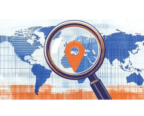 https://bourgoing.com/wp-content/uploads/2024/11/Tuto08.png
816
1456
Robert Bourgoing
http://bourgoing.com/wp-content/uploads/2021/11/Robert-Bourgoing-couleur.svg
Robert Bourgoing2024-11-20 13:10:222024-12-12 11:56:278. Geolocating Photos and Videos – part 1
https://bourgoing.com/wp-content/uploads/2024/11/Tuto08.png
816
1456
Robert Bourgoing
http://bourgoing.com/wp-content/uploads/2021/11/Robert-Bourgoing-couleur.svg
Robert Bourgoing2024-11-20 13:10:222024-12-12 11:56:278. Geolocating Photos and Videos – part 1
 10. Fact-Checking Websites